Holiday planning
Dachmarke Suedtirol
Holiday planning
telephone-white Call us email-white Write us whatsapp-white WhatsApp arrow-white 360° View
A family at the Totenkirchl church

Impressive

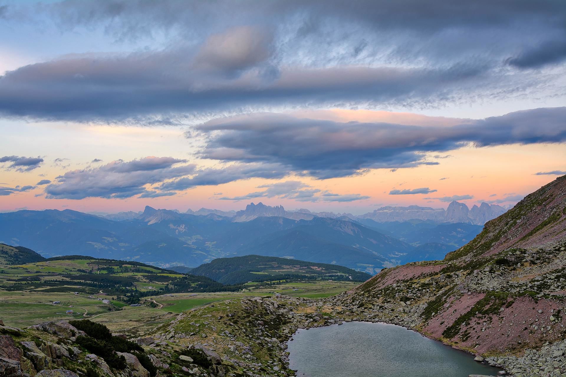
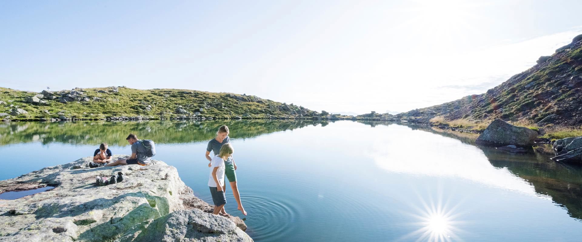
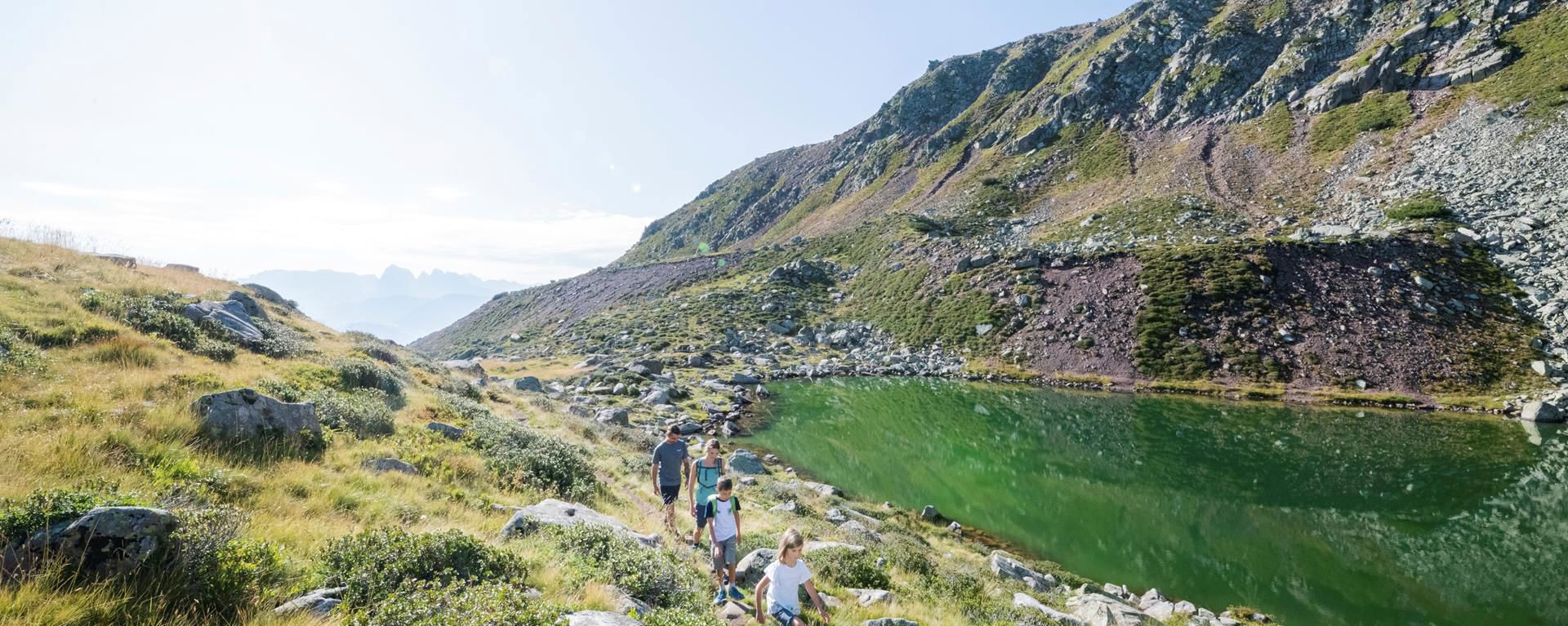
Totenkirchl church & lake Totensee
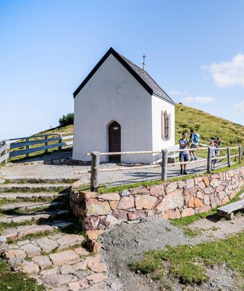
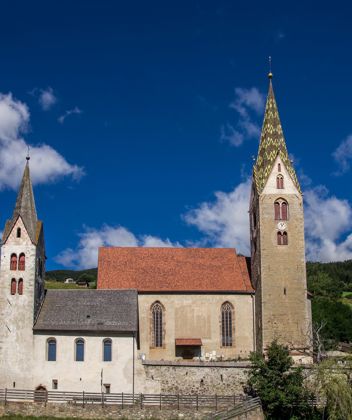
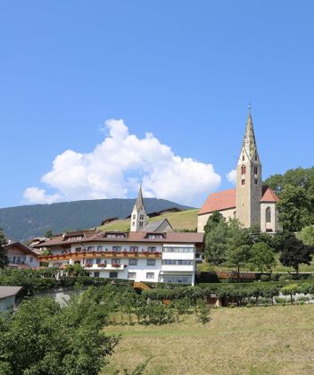
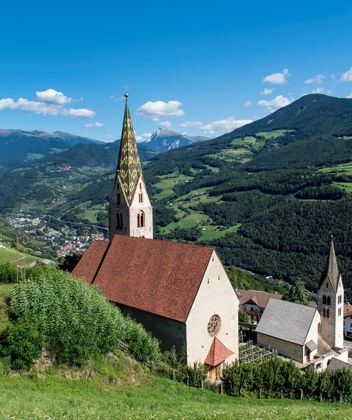
Totenkirchl church

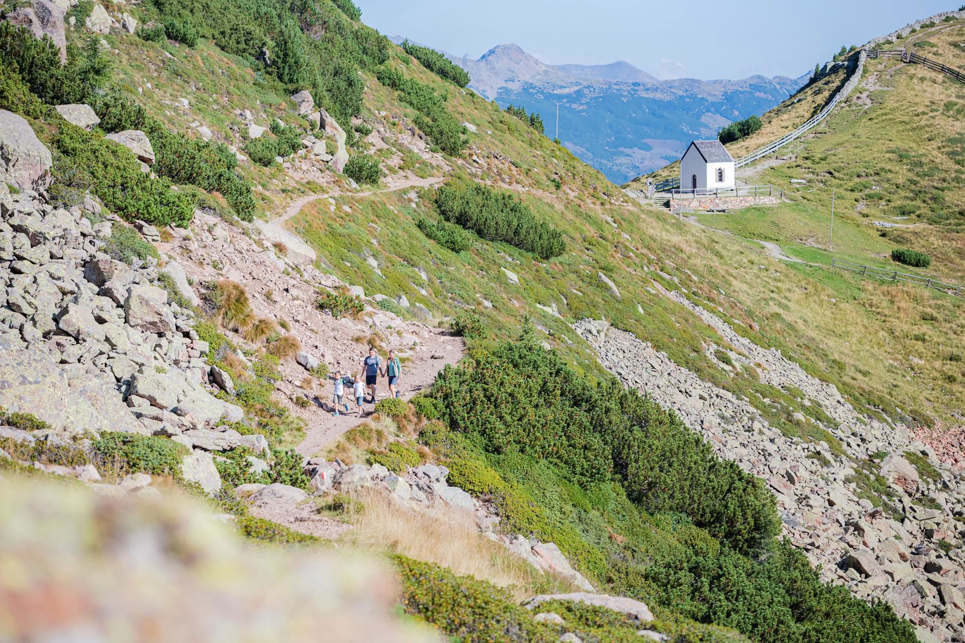
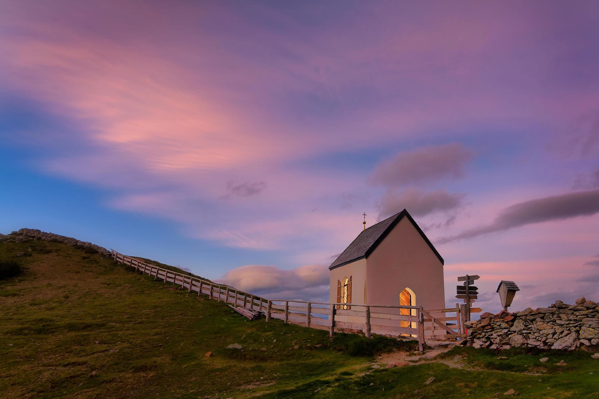
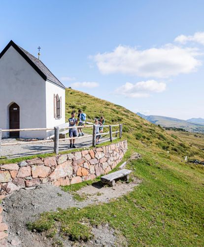
The church Totenkirchl is located at 2186 m above sea level on the Villanders mountain pasture, which is one of the largest high alpine pasture in Europe. It was probably built by some miners who lived in this mountain area at the time.

Because of its exposed position, the chapel requires frequent restoration cycles to the building. In its present form, it was built in 1899. The last renovation took place in 1981 by the Villanderer Schützen.

Worthy of note is the Crucifixion group inside the church.

Both on the side of the Villanderer Alm and on that of the Sarntal the Stations of the Cross lead to this probably oldest place of pilgrimage of South Tyrol. Inspired by the name, it became a custom in the region to hang memorial prayer cards in the chapel to commemorate the dear departed.
Lake Totensee

The beautiful mountain lake is unique and probably too cold for most people to swim, but it is equipped with comfortable wooden loungers. The fact that the landscape is barren is certainly not important to the hiker at this point, because from up there you have a breathtaking panoramic view of the Dolomites
At the Totensee Lake
FRESH
Lake Totensee
The lake Totensee (literally translated, "lake of the dead") is located in a mountain hollow below the chapel. The macabre name comes from the agricultural term "dead", which can be interpreted as "fruitless".
Hiking trail

Saltnerstein (Gasser Hut) – church "Toten" – Saltnerstein

Hiking trail · Eisacktal
Responsible for this content
Klausen, Barbian, Villanders, Feldthurns
  • Totenkirchl Church
    Totenkirchl Church
    Photo: Helmut Moling, Klausen, Barbian, Villanders, Feldthurns
Map / Saltnerstein (Gasser Hut) – church "Toten" – Saltnerstein
moderate
Distance 14.4 km
4:25 h
569 m
569 m
2,223 m
1,749 m
Hike to the Alps of Villandro/Villanders with panoramic view....
Difficulty
moderate
Technique
Stamina
Experience
Landscape
Highest point
2,223 m
Lowest point
1,749 m
Best time of year
Jan
Feb
Mar
Apr
May
Jun
Jul
Aug
Sep
Oct
Nov
Dec

Track types

Show elevation profile

Start

Coordinates:
DD
46.641367, 11.490071
DMS
46°38'28.9"N 11°29'24.3"E
UTM
32T 690568 5168323
w3w 
///querying.brisk.rinse

Turn-by-turn directions

Vom Ausgangspunkt am Saltnerstein (Gasser Hütte) wandern wir auf dem Kreuzweg mit der Markierung Nr. 6 an der Pfroderalm vorbei bis zum Totenkirchl. Weiter führt die Wanderung über Weg Nr. 16 zum Prackfiederer Jöchl und zur Stöfflhütte. Von dort folgen wir Weg Nr. 15 an der Marzunerschupfe (ca. 5 min. vom Wegverlauf) und der Mair in Plun Hütte vorbei zum Ausgangspunkt. (Im Winter fast bis zum Totenkirchl gespurt).

Directions

In Villanders folgt man zunächst der Ausschilderung zur Villanderer Alm (an der DESPAR rechts ab). Nach ca. 20 Minuten Fahrzeit gelangt man an den kostenpflichtigen Parkplatz Gasserhütte.

Coordinates

DD
46.641367, 11.490071
DMS
46°38'28.9"N 11°29'24.3"E
UTM
32T 690568 5168323
w3w 
///querying.brisk.rinse
Get there by train, car, bike, or on foot!

Similar routes nearby

  • Family Hike
  • From Villanders to the "Totensee"
  • Saltnerstein (Gasser Hut) - Mountain of Villanders
  • Circular route Alp of Villanders/Villandro
  • Gasser Hütte- Rittner Horn
 These suggestions were generated by our system
Difficulty
moderate
Distance
14.4 km
Duration
4:25 h
Ascent
569 m
Descent
569 m
Highest point
2,223 m
Lowest point
1,749 m

Weather at the route's trailhead

Statistics

  • Content
  • Show images Hide images
Features
Maps and trails
Distance  km
Duration : h
Ascent  m
Descent  m
Highest point  m
Lowest point  m
Push the arrows to change the view
A family at the Totensee Lake